Overview
Location
Eastern Athabasca Basin, Saskatchewan, Canada
Ownership
100% IsoEnergy
Deposit Type
Unconformity related basement hosted uranium
Stage
Exploration
Primary Minerals
Uranium
Highlights
- The East Rim project straddles the eastern margin of the Athabasca Basin 8 kilometres south of the West Bear Uranium-Nickel-Cobalt Deposit
- The project comprises 12 claims totaling 25,111 hectares.
Geology
IsoEnergy’s East Rim property staddles the southeastern edge of the Athabasca Basin and is underlain by both the Athabasca Sanstone and by basement rocks of the Wollaston Domain. Quaternary overburden consists of a thin layer of ablation till. The property area is covered by glaciofluvial sands and gravel in the form of eskers, and moraines. Below the overburden, approximately 60% of the property is underlain by Athabasca sandstone which unconformably overlies Paleoproterozoic basement rocks. The remainder of the property lacks sandstone cover and is directly underlain by Wollaston Group rock beneath glacial till (where present).
Exploration Potential
2023 exploration activities on the East Rim property successfully advanced the project to a near drill-ready state. Activities included data inversion of previous airborne surveys which identified several magnetic and density lows, indicating potential for basement-style uranium mineralization, VTEM airborne surveying which identified broad conductive zones in the western and south-western portions of the property, and ANT surveying which identified an abrupt velocity anomaly within the more southern conductive zone.
Geotech Ltd conducted a helicopter-borne Versatile Time Domain Electromagnetic (VTEM™ Plus) and horizontal magnetic gradiometer geophysical survey. The survey covered 1,136 line-kilometres. The VTEM™ Plus system is excellent at locating discrete conductive anomalies as well as mapping lateral and vertical variations in resistivity. A conductivity domain outlined by the 2023 VTEM survey, density low anomalies identified by the 2022 Falcon gravity survey, historic ground EM conductors and alteration in historic drill holes are all present in the area of interest. 2024 exploration activities integrate the surveys and include a program of 1,050m in 3 drill holes targeting the coincident geophysical anomalies.
Importantly, the sandstone cover on the property is thin, ranging from no sandstone cover to 265m in previous drilling. Efforts at the early-stage have continued to focus on basement-hosted targets where multiple layers of geophysical data stack and allow the Company to vector into a potential uranium mineralized system located under this thin cover.
Technical Maps
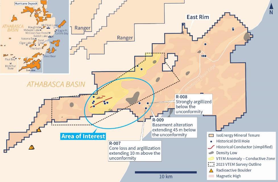
East Rim map with an area of interest outlined. A conductivity domain outlined by the 2023 VTEM survey, density low anomalies identified by the 2022 Falcon gravity survey, historic ground EM conductors and alteration in historic drill holes are all present in the area of interest.
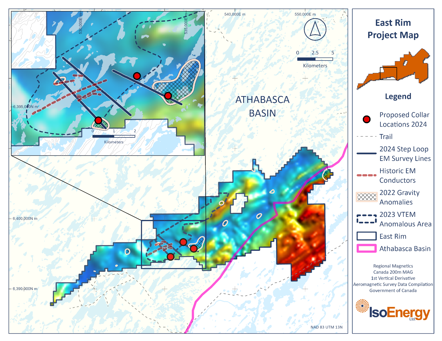
East Rim project map showing the locations of the summer 2024 planned diamond drilling.
