Overview
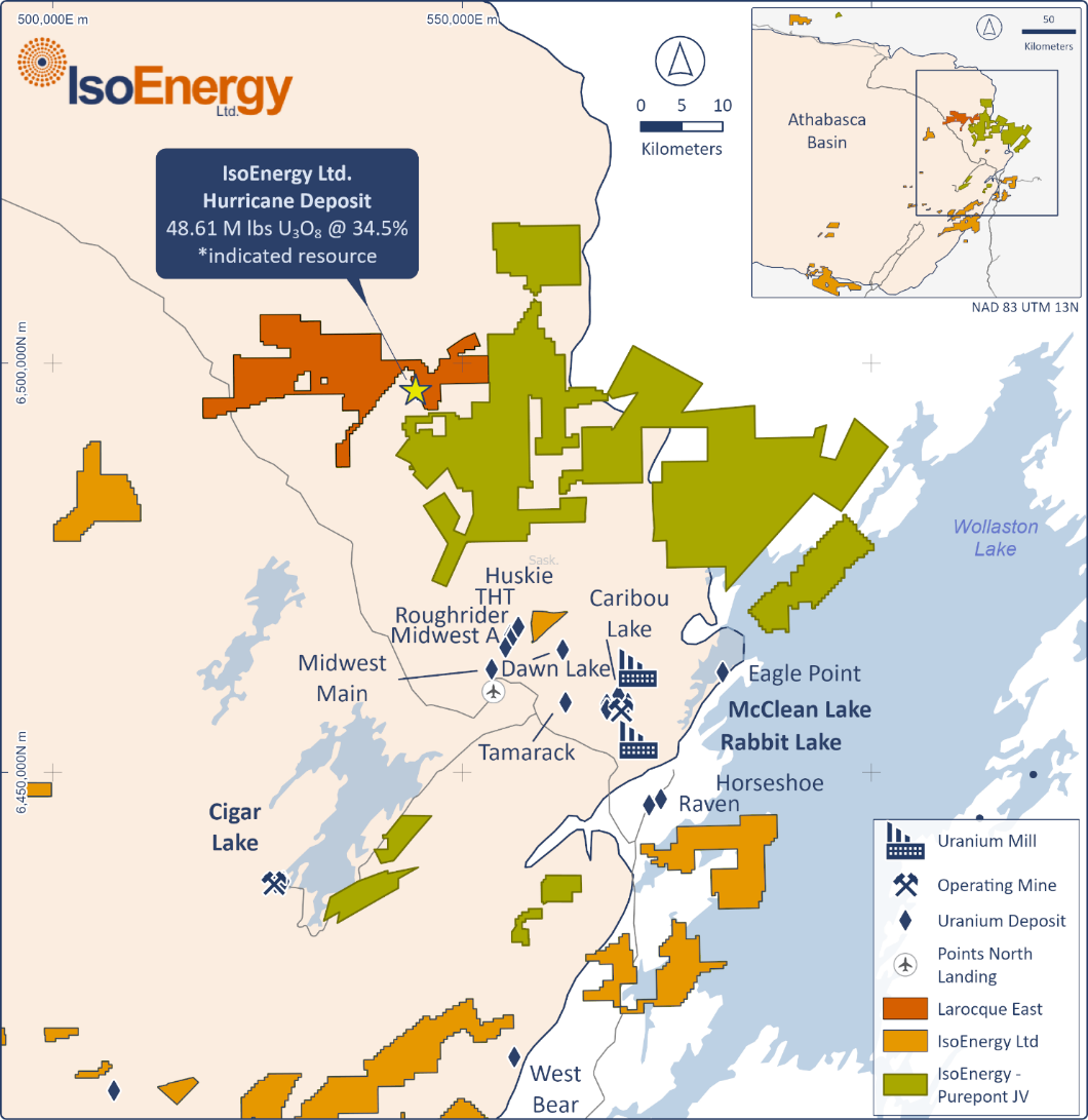
Location
Eastern Athabasca Basin, Saskatchewan, Canada
Ownership
100% IsoEnergy
Deposit Type
Unconformity related sandstone and basement hosted uranium
Stage
Exploration
Primary Minerals
Uranium
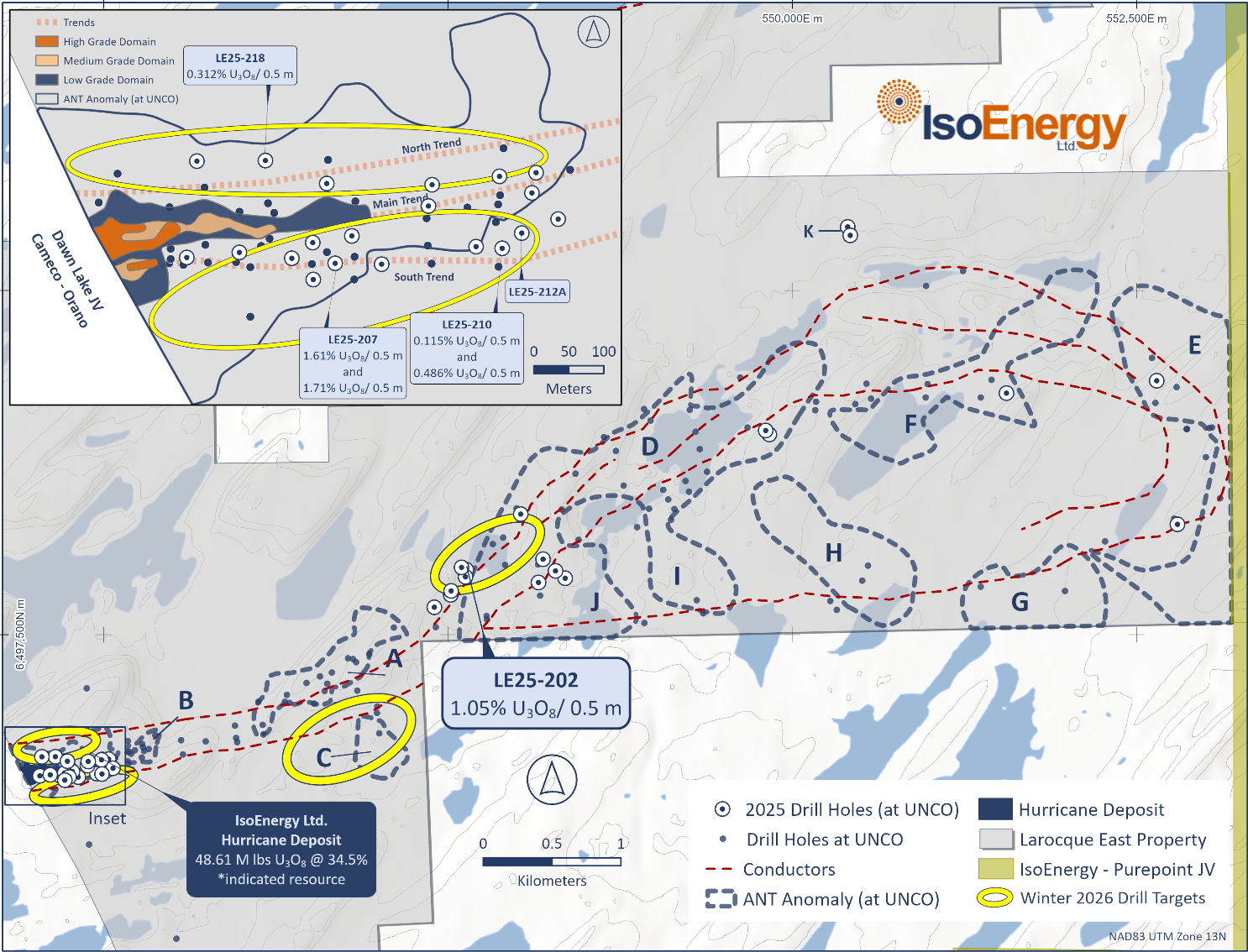
Technical Maps
Larocque East 2026 winter drill target areas focused on the Hurricane Deposit
Location of IsoEnergy’s Larocque East project and Hurricane Deposit.