Overview
Location
Québec, Canada
Ownership
100% IsoEnergy
Deposit Type
Unconfirmed
Stage
Exploration
Primary Minerals
Uranium
Highlights
- Located in North-Central Quebec, approximately 150km north of the Hydro-Quebec Reservoir and within the Gayot Lake outlier of the Sakami Formation
- Formerly held by Uranerz Exploration and Mining, Strathmore Minerals Corp., Fission Energy Corp. and Denison Mines Corp.
- Quebec ranks highly as a mining jurisdiction and has seen significant past expenditures on uranium exploration by both major and junior mining companies
Historic Mineral Resource Estimate
| Category | Tonnes (M) | Grade (% U3O8) |
Contained (M lbs) |
|---|---|---|---|
| Inferred | 19.3 | 0.057% | 24.4 |
Scroll to the right to see the table data.
For additional information regarding the Dieter Lake Project, please refer to the Technical report entitiled "Technical Report on the Dieter Lake Property, Quebec, Canada" dated October 7, 2011, prepared by Davis & Guo using the Thiessen (Voronoi) polygon method. Data constraints used were 200 ppm, 500 ppm, and 1000ppm U3O8 over a minimum of 1 metre thickness. Polygons created had radii of 200 metres. A rock density of 2.67g/cm was used.
This resource is a historical estimate under National Instrument 43-101 – Standards of Disclosure for Mineral Projects ("NI 43-101") and a qualified person has not done sufficient work to classify the historical estimate as current mineral resources. As a result, the historical estimate is not being treated as a current mineral resource.
Geology
The Dieter Lake Property is located in North-Central Quebec and occurs within a Lower Proterozoic sedimentary basin, within the Superior Structural Province of the Precambrian Shield. Between Hudson Bay and Labrador Trough, north-central Quebec, are two east-west trending belts of sedimentary outliers attributed to the Sakami Formation. The Gayot Lake outlier, which is host to the uranium mineralization at Dieter Lake, measures approximately 52 km east-west, by 12 km north-south. Suggested deposit types for the uranium mineralization at Dieter Lake have included unconformity-type, black shale type, and syngenetic stratabound.
Uranium mineralization at Dieter Lake is in the form of fine-grained, sooty pitchblende within a shale-wacke horizon of the Sakami Formation. The pitchblende is accompanied by various sulphides and moderately associated with metallic elements Fe, Cu, V and Mo. The uranium ore horizon bed has been traced over an east-west distance of 5 km and is generally 20 to 80 m above the unconformity. It ranges from 0.2 to 3 m thick and has been observed up to 5 m thick.
Exploration Potential
Planned 2025 Work
A helicopter-borne magnetic survey is planned for July or August 2025. The survey location and flight lines are shown on Figure 1. A total of 661 line-kilometres will be flown with flight lines spaced 50 metres apart. The survey is estimated to take three days to complete. The geophysical information derived from the survey will be used to refine to geological interpretation of the Dieter Lake project. More information is provided in Exploration Work Annual Planning 2025.
Technical Maps
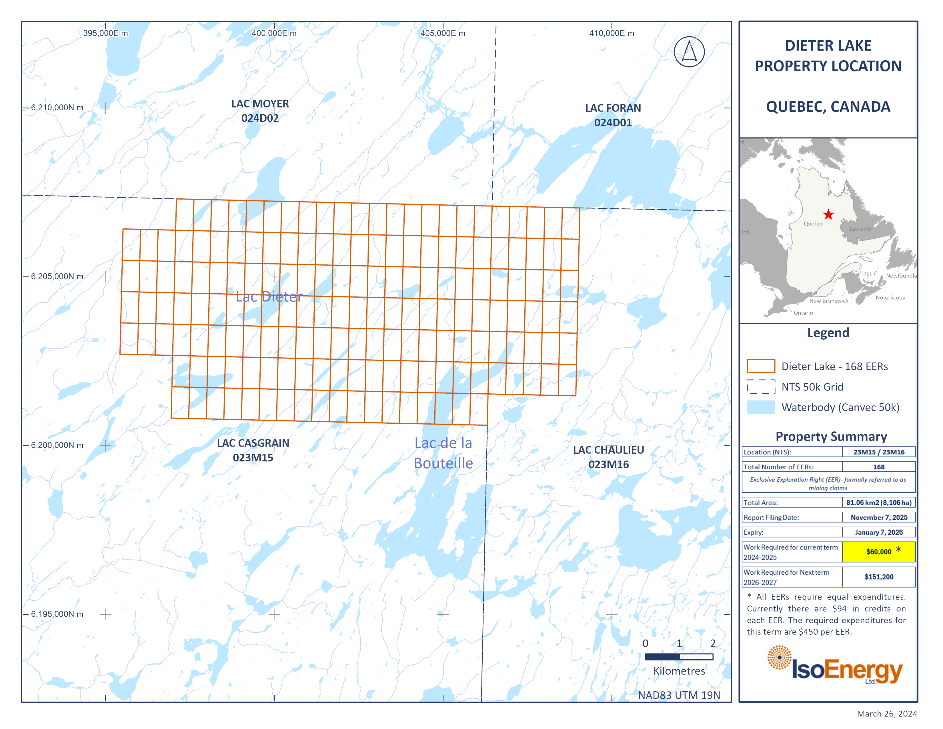
Figure 1. Planned Summer 2025 helicopter-borne magnetic survey of the Dieter Lake project in Quebec
